We slept late, it is so hard to tell what time it is here with the constant light. Packed up and hit the road. We were the last ones out of the campsite. A km or 2 up the road there were 2 cyclist also heading south, they were riding 1 on each side of the road. As we got closer we thought that the one on the left would move over and ride behind his friend. Nope, they stayed on opposite sides and we had to drive between them. I don’t think we have mentioned before the fact that in most places the Dempster has 2-3 tire tracks that are sort of hard packed. In this spot there were 3, the cyclists were using the 2 outside ones, which left a space about a car width between them, and we had to drive on loose gravel while passing them. For the rest of the day we hoped that they were safe as we had barely had enough room to pass and after we crested the hill, we passed motor-homes heading south.

One of our forest friends at Rock River
At 10:30 we crossed the arctic circle, bringing that portion of our adventure to a close. But no worries, we still had a full day of driving on the Dempster to keep the adventure factor up. We made the requisite stop for gas at Eagles Plains (population 9), grabbed a drink, checked the weather forecast for Tombstone (cloudy but no rain, Yay!), and got back on the road. There was a forest-fire burn we had seen on the way up that seemed to be from last year, as there was not yet any shrubs growing, but there were white flowers in abundance. We kept an eye out for that as I wanted to get some shots. We found one, that didn’t look quite like what we remembered, but we thought that the “flowers” which were like mini dandelions gone to seed, had mostly run their course. I got out, trudged into the burn an bit and got some pics, then we headed on again. A little way done the road, we found the burn that we had actually been thing of, so stopped again for some pics.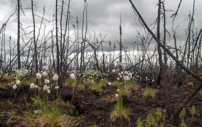
About 10 minutes down the road I reached into my pocket to grab my phone for charging and found that it wasn’t there. FRIG! I had no idea if I had left it at Eagle Plains, or if it had fallen out of my pocket at one of the 2 places we stopped for pics. We turned around and looked for the last place we had stopped. Surprisingly we found the place on the road we had pulled off, and then found the spot in the burn where I had taken the pictures. There was no phone to be found. I knew that there was no chance of finding the previous stop, and Eagle Plains was about 1.5 hours away. So we pointed south again, and headed for our destination for the day, Tombstone park. We would call Eagle Plains when we got back into cell service in 2 days.
The one thing that made losing the phone bearable was knowing that I had uploaded pics to the blog site while we were in Inuvik, as there were pics of us at the signs to NWT, Tuk, Tuk road, and a few selfies from along the way. Still, it set an somber mood for the day.
There were still a lot of sites open at Tombstone, so we found a nice one that even had a tent pad and set up camp. Surprisingly, it started to rain while we were setting up. The pop-up shelter we brought really has made the difference for us. We played some cards then called it a night. I had been sulking about the phone since I discovered it gone and continued to do so into the we hours of the morning, unable to sleep. I didn’t realize home much my phone really is my security blanket. Not having cell service or wifi is fine, just don’t take my phone, as it contains my life.
