Monthly Archives: June 2018

Tuk 2018 – Day 12 – Back to Dawson City we go.

Standard

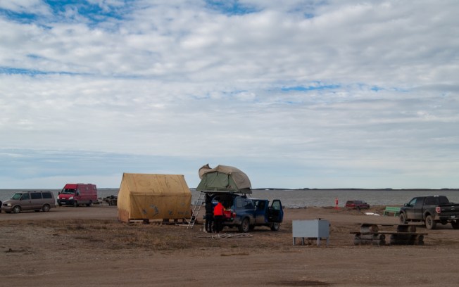
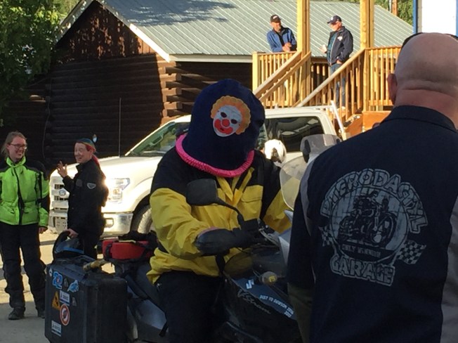
It was still raining hard and was cold when we got up early. We had planned to stay for 2 nights and do a day hike today, but not in the rain. So, for the first time this trip we had to pack in the rain. Tent and shelter went into the back of the car soaking wet. We hoped that we would find a site to set up early enough in the day for things to dry out before we had to go to bed. We didn’t even want to make breakfast. Dawson City was the closest cell service and we had to call about the phone, so we figured we would just have brekkie there.

It is only 90ish km from Tombstone to the end of the Dempster. I have never been so happy to get to the end of a road before. We headed west into Dawson and enjoyed the drive on pavement, it noticeably changed our moods. We had hoped to stop at the Alchemy Café again, but they didn’t open for another hour and I would way to hangry by then, so we went to the Triple J hotel. Linda called Eagle Plains from the restaurant to ask about the phone. Yes, it was there. Yay! Can they ship it? No, there is no postal or courier service there. She would have to send it with a customer who was heading for Dawson, and would call us if she could find one. Great! But, that would mean we have to stay in Dawson for the night as she also told us the weather on the Dempster was “horrendous” and if she found someone it would take them a long time to get there. So we booked a room at the hotel, there wasn’t one available that early in the day, but should be by noon. About 10 minutes later, Eagle Plains called to say that Elvis is bringing my phone to Dawson.  We let the front desk know that someone would be dropping off a phone for us then went to the museum to pass the time while we waited for a room.

The museum has some very good displays showing the history of Dawson, the gold rush and placer mining. I was able to show Linda the route of the Percy DeWolfe memorial mail dogsled race that I did many moons ago. The 320km race honours Percy DeWolfe who, from 1910 – 1949, delivered the mail between Eagle Alaska and Dawson City by boat, dog team and horse. The museum also has a room of of displayed artifacts behind glass on shelves, so though there is little in the way of descriptions for them, they are very neat to see. Definitely $9 well spent. Fun fact: The museum also serves as the courthouse every couple of months.

We got back to the hotel at noon and the room was indeed ready. We both needed a hot shower and were looking forward to a warm soft bed for the night. The hotel even had a free washer and dryer for us to use. So, we took the opportunity to de-stink ourselves and our clothes. Linda also made a new friend in the stairwell.img_1583

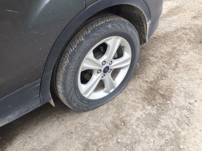
The car was in desperate need of a bath, having a nicely textured coating of Dempster mud on it. So we found a wand wash on the out skirts of town.

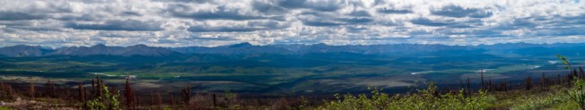
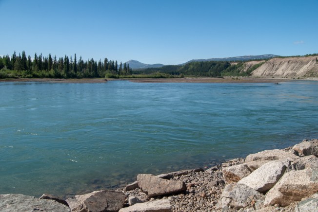
On the way back to town we headed up the Dome Road. We didn’t get the chance to do this last week as it was raining the day we were going to hike up, so I was glad we had another opportunity. From the top of the dome you can see most of Dawson City, and can look down the Yukon River valley.  It really is a great view.

We also took a stroll around, looking at many of the historic buildings and displays that are spread across the town. The SS Keno, a sister of the SS Klondike in Whitehorse, sits on the waterfront and is operated by parks Canada. In fact the whole town is a National Heritage Site, and has very strict roles on development. The benches along one of the streets were built to look like old shipping crates, very cool.

Klondike Kates used to be the go to place for brunch when I worked in Dawson years ago but we discovered last week that they no longer do brunch, only supper. We had heard that the food was still amazing, so decided to go there for supper.. It was raining when we got there, and it was a 20-minute wait for a table. There are benches outside for people who are waiting, but they are not covered. So everyone who was waiting huddled under the awning on one of the heritage display building across the street. The restaurant would yell over who was up next.

The wait was worth it though. Linda had the daily special of tourtiere, a good choice in a restaurant that has real Quebec curd on its poutine. It smelled amazing and tasted even better. I had the sausage plate, which had a Bison/blueberry sausage and an Elk/cranberry sausage. We were both very happy with the food and would recommend this place to anyone. They strive for locally sourced and scratch made food.

We had intended to go to the Westminster Hotel bar last week but got way-laid somewhere along the way. We had the time tonight, so headed over for a beverage. The Westminster is a Dawson City icon, referred to as “The Pit” likely because of its condition, though I stand to be corrected on that, and the “Pink Palace” in reference to its exterior colour. The floor is so uneven that even sober people look like drunken sailors as they walk across it. The décor is rather interesting, with a few risqué paintings on the walls. It certainly gives you a bit of the colour of Dawson City.

dawson (1 of 1)Diamond Tooth Gertie’s Casino is right across the street from the Triple J hotel where we were staying. So, just for something different we popped in to play the tables a bit. This time however, we ended up coming out with more than we went in. Always a good day at the casino when you can do that. Sorry Klondike Visitors Association, we took back most of what we donated last week.

We knew enough to quit while we were ahead, called it an early night and enjoyed the warm soft bed. We both slept like logs.

PS: I thought I should include a pic of a Tuk-U shirt. In my mind everyone would know what I was talking about, but Linda was surprised when she saw it.dawson (5 of 1)

Tuk 2018 – Day 11 – Tombstone Park

Standard

We slept late, it is so hard to tell what time it is here with the constant light. Packed up and hit the road. We were the last ones out of the campsite. A km or 2 up the road there were 2 cyclist also heading south, they were riding 1 on each side of the road. As we got closer we thought that the one on the left would move over and ride behind his friend. Nope, they stayed on opposite sides and we had to drive between them. I don’t think we have mentioned before the fact that in most places the Dempster has 2-3 tire tracks that are sort of hard packed. In this spot there were 3, the cyclists were using the 2 outside ones, which left a space about a car width between them, and we had to drive on loose gravel while passing them. For the rest of the day we hoped that they were safe as we had barely had enough room to pass and after we crested the hill, we passed motor-homes heading south.

day 11 (16 of 1)

One of our forest friends at Rock River

At 10:30 we crossed the arctic circle, bringing that portion of our adventure to a close. But no worries, we still had a full day of driving on the Dempster to keep the adventure factor up. We made the requisite stop for gas at Eagles Plains (population 9), grabbed a drink, checked the weather forecast for Tombstone (cloudy but no rain, Yay!), and got back on the road. There was a forest-fire burn we had seen on the way up that seemed to be from last year, as there was not yet any shrubs growing, but there were white flowers in abundance. We kept an eye out for that as I wanted to get some shots. We found one, that didn’t look quite like what we remembered, but we thought that the “flowers” which were like mini dandelions gone to seed, had mostly run their course. I got out, trudged into the burn an bit and got some pics, then we headed on again. A little way done the road, we found the burn that we had actually been thing of, so stopped again for some pics.day 11 (2 of 1)

About 10 minutes down the road I reached into my pocket to grab my phone for charging and found that it wasn’t there. FRIG! I had no idea if I had left it at Eagle Plains, or if it had fallen out of my pocket at one of the 2 places we stopped for pics. We turned around and looked for the last place we had stopped. Surprisingly we found the place on the road we had pulled off, and then found the spot in the burn where I had taken the pictures. There was no phone to be found. I knew that there was no chance of finding the previous stop, and Eagle Plains was about 1.5 hours away. So we pointed south again, and headed for our destination for the day, Tombstone park. We would call Eagle Plains when we got back into cell service in 2 days.

The one thing that made losing the phone bearable was knowing that I had uploaded pics to the blog site while we were in Inuvik, as there were pics of us at the signs to NWT, Tuk, Tuk road, and a few selfies from along the way. Still, it set an somber mood for the day.

There were still a lot of sites open at Tombstone, so we found a nice one that even had a tent pad and set up camp. Surprisingly, it started to rain while we were setting up. The pop-up shelter we brought really has made the difference for us. We played some cards then called it a night. I had been sulking about the phone since I discovered it gone and continued to do so into the we hours of the morning, unable to sleep. I didn’t realize home much my phone really is my security blanket. Not having cell service or wifi is fine, just don’t take my phone, as it contains my life.

Tuk 2018 – Day 10 – What goes up must come down.

Standard
Tuk 2018 – Day 10 – What goes up must come down.

We had a remarkably good sleep considering how chilly and windy it was last night. That hot-water bottle was a great help, not to mention the stylish head gear. The ensured everything was dry for packing up this morning though, so that was a nice bonus. It also meant that we had to cook in the car, as the heat was being blown away.

After everything was packed up, we put on our sandals and waded into the ocean. OMG was it freekin cold! I have been in glacial lakes and thought it would be pretty much like that. Boy, was I wrong! And, I have to confess that the original plan was to put on bathing suits and take a quick dip, but we wussed out and only went in to our shins.Day 9 (4 of 1)

We stopped at the Northern Store looking for Tuk shirts, but they didn’t have anything that really grabbed us, and I was looking specifically for a Tuk-U shirt. So, we headed over to the town office, they didn’t have Tuk-U shirts, but we wanted to support the local economy at least a little, so I picked up a long sleeve T-shirt, some stickers and we got our “I traveled the highway to the arctic ocean” certificates. We seem to be getting quite a collection of certificates from this trip. We’ll have to scan them when we get home to put them in our photo book of the trip.

We drove around town looking at the sites and taking photos. We discovered that Tuk is the northern end of the Trans-Canada Trail. We also saw a sod house, and the under structure for making a sod house.Day 9 (9 of 1)

Just outside of Tuk is Pingo National Park. Pingos earthen domes unique to the north and are formed when lakes dry up and permafrost pushes up the previous unfrozen ground and water. There are around 1400 around Tuk, ranging in height from 3 to 45 meters.Day 9 (11 of 1)

The road to Inuvik was just as challenging as when we came up, but it seemed to go by a faster even with us stopping to take some pics we didn’t get the day before. One thing we found interesting is that snow-machines and sleds (kamiks) are left in what seems to be random places along the road. We wondered if they might be at someone’s trap-line, but honestly we have no idea and sometime we just make stuff up.Day 9 (12 of 1)

When we got to Inuvik, we had hoped to have lunch at Alestine’s Restaurant as they are rated the best in town and serve local fare such as Reindeer chili, local fish and Eskimo donuts which are pretty similar to what we would call fry bread on the prairies. Alas, they are only open for supper until next week. There are not a lot of restaurants in Inuvik and after looking at short list we picked up at the visitors centre that included the hospital cafeteria, we decided on Cloud 9 at the airport. As we didn’t want to have to double back we decided to get gas and do our shopping before we left for the airport. Still in search of a Tuk-U shirt we headed over to Mavis’ house as she sells the shirts. We were looking for some sort of sign attached to a house, but no, there was nothing. I did see a woman standing in her window waving us in, so figured we had found the right place. Unfortunately, she had no Tuk-U apparel left and wouldn’t get any until next week. Too late for us. She did have a great assortment of hand-crafts, the bead-work on the moccasins was amazing. It seems she used to work for the development corp and when she left the elders kept bringing her their work anyway. The north really is a different place, with a different pace of life and a different way of doing things than we are used.

Next stop was the Inuvialuit Development Corporation. They have a craft shop and hold the copyright for the Tuk-U apparel. At last, we sort of had success. There were only 4 shirts left, 2 small and 2 XXL. Since it took me over 40 years to get here to pick one up I couldn’t leave empty handed, so picked up an XXL sweatshirt. Maybe it will shrink a little, and I can always use it as a hoodless hoodie.

Lunch at the airport was ok, but certainly not something to write home about. If we lived in Inuvik, I don’t think we would be eating out much. The airport did have decent wifi though, so I was able to upload some pics to the blog. The relevance of this will become import in the next day’s blog.

Although the scenery is beautiful, we are starting to be done with the Dempster, and are looking forward to hitting pavement again. So, even though we had intended to make a stop in Tsiigachtic, it would mean an extra ferry crossing, so we went directly to the McPherson landing and continued south. A little after McPherson, there was a lot of road maintenance going on, grading and applying calcium chloride. Although it made the road wet and slippery, it also got rid of the dust that made visibility quite bad.

We ended up in Rock River again for the night. Had a lovely campsite right by the river even though it was a little busier than it was 2 days ago. Our food supplies are starting to get a little low, but we got creative and had quesadillas for supper. Just one more way to serve pepperoni, olives and cheese 😊 By the end of the trip I may not want to have any of the above for a long time.

Day 9 (16 of 1)
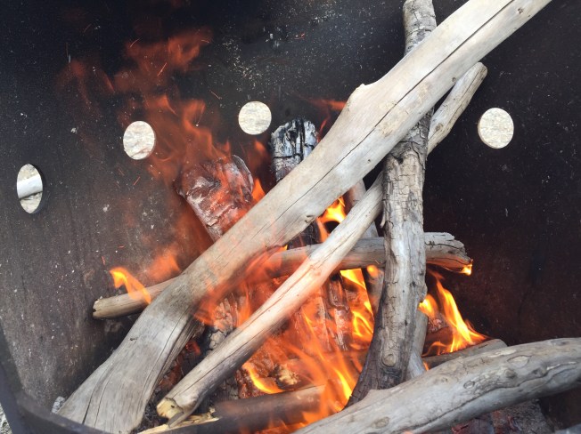
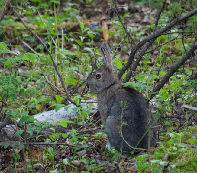
As we were getting dinner ready and sitting by the fire afterwards, we were visited by a rabbit (Arctic hare?) with white feet who did not seemed afraid of us, and seemed to be friends with a squirrel, we also had a grey jay come and visit and we were expecting Snowwhite to pop out of the forest at any minute.

Tuk 2018 – Day 9 – Most Northern road in Canada

Standard
Tuk 2018 – Day 9 – Most Northern road in Canada

We slept a bit late after a cold night in the tent. If we were this cold here, it should be fun in Tuktoyaktuk!

The clouds were very low and made driving a bit challenging as we went through Wright Pass into the the Northwest Territories.

Day 9 (1 of 1)

Of course we stopped at the NWT  border for a pic. We also learned that not only do birds migrate to the western arctic from all over the Americas, the Northern Wheatear migrates from Northern Africa. Now that is one heck of a trip! Shortly after we left the border we encountered a Grizzly running down the road towards us. Unfortunately it dashed off into the bush before we could get a pic, but Linda was happy as she had never seen a griz before. We also saw 2 arctic foxes along the way. Again, no pics, but really we did see them.Day 9 (2 of 1)

Our next stop was at a view point that gave a 180km view down the Mackenzie Delta. The vastness of this land continues to amaze us.Day 9 (2 of 1)

There are 2 ferry crossings on the way to Inuvik. The first one is the Peel River ferry, a cable ferry that operates on demand.Day 9 (3 of 1)

Next was a quick stop into Fort McPherson to get our passports stamped, then back on the road to the MacKenzie River ferry at the confluence of the MacKenzie and Arctic Red Rivers. This ferry has 3 landing points, 1 on the McPherson side of the Dempster, the 2nd is for Tsiigachtic a small village between the 2 rivers, and 3rd is on the Inuvik side of the MacKenzie.

Day 9 (4 of 1)

We stopped for directions and our Arctic Circle certificates at the visitor centre in Inuvik, got fuel at Bob’s Welding, and hit the road.img_1552

If we thought the Dempster was a bit challenging before, it now seemed like a cake walk compared to the new Tuk highway. Because it is such a new road, there are many areas that have not quite settled in yet and for many kms the gravel is deep and loose, it is like driving in sand. There is a not bad section in the middle, then many kms of pot holes and washboard. We drove slow and had ample opportunity to enjoy the view.  2.5 after we left Inuvik, We’ve arrived!img_1553

We stopped at the RCMP to ask where we could camp, as there are no campgrounds in Tuk. In Dawson we had heard that people were using the ball diamond and “the point” The RCMP told us the point was our best bet, so we joined a handful of other die-hards who were spending the night here and not heading right back to Inuvik. There were only a few other tents most were campers or vans. We got a site about 50 yards from the shore of the arctic ocean with the use of a picnic table and fire pit. It was very cold and windy and we used the car as a windbreak for the tent. We also put on all the headgear and jackets we brought with us.

Day 9 (5 of 1)

Linda gathering driftwood from the Arctic Ocean

Dinner was weenies roasted over an ocean driftwood fire, and canned beans. img_1559

Some enterprising residents have erected a wall tent and will be running a concession from it shortly. In the mean time, flyers taped to the outhouses let you know that you can get burgers and hot dogs delivered to your tent.

We campers seem to be a source of entertainment for the town.  Carloads of residents drive around the point to look at us. It kind of makes us feel like we are in a zoo, but is fun none the less.

Day 9 (6 of 1)

Campers at “The Point”

As one might imagine, is was chilly sleeping in a tent a few feet away from the Arctic Ocean in June. We used a Nalgene bottle as a hot water bottle and even I had pants on in the sleeping bag. img_1560

The influx of tourist, and campers has put an extra burden on the town, for example the porta-poties need to be emptied with greater frequency. And, I think so far the economic benefit to the town has not been that great. Next year will look a lot different I think, with an actual campsite, and fees. We feel privileged to be in the first few to experience it the way it is this year.


Tuk 2018 – Day 8 – Into the Arctic

Standard
Tuk 2018 – Day 8 – Into the Arctic

We woke up raindrops sitting on the tent, but at least it wasn’t actually raining while we packed up. We had a later start than we hoped today, but ended up getting to the campsite we had wanted to anyway. Dawson was fun, but it is good to be getting away from the bars and casino.

Today was north on the Dempster Highway. Highway is a strong word for this road. It is a 900km unpaved road from just outside of Dawson City to Tuktoyaktuk, with the Inuvik to Tuk portion just opening this year. The Yukon portion of the road is made from shale, treated with calcium chloride. It is super hard on tires and either very dusty when dry, or slippery when wet. The best time to drive it is within a day after rain, so we were hitting it at a great time.Day 6 (6 of 1)

Our first stop was the Tombstone Territorial Park Interpretive Centre. We popped in to get our Dempster Highway passports stamped, but also took the chance to ask them a few questions, as we plan to stop there on the way back down. Day 6 (2 of 1)

The next stop was  our first unplanned stop of the trip about 16km short of Eagle Plains when the low tire pressure light came on. A quick look at the tires didn’t show any visible damage, and Eagle Plains was close so we pressed on.  By the time we got to Eagle Plains, and pulled up to the gas pumps, the left-rear tire was visibly low. By the time the tire repair guy came to look at it, it was flat as a pancake.  He showed us the damaged spot, a finger sized hole was punched through the tread, likely from a sharp rock. Luckily, it was repairable, so we were back on the road with our wallets being not much lighter. (We were even pleasantly surprised at the price of gas) We are not sure if speed was a factor, but slowed down even more for the remainder of the road.img_1537

Next up, about 35km from Eagle Plains, was the Arctic Circle, a first-time experience for Linda. Welcome to the arctic explorer club! Of course, we stopped for a photo op.Day 6 (4 of 1)

The scenery along the Dempster is amazing, and changes all along the way. From the sharp peaks of the Tombstones, the expanse of Eagle Plains, and the undulating Richardson Mountains. It is next to impossible to describe the vast expanse of the land. Linda said she had never seen anything like it before, I know I hadn’t the first time I drove it. It was nice to be the passenger for most of it this time, as I got to take in all the viewsDay 6 (5 of 1)

Near Engineer Creek Campground we passed by treeless mountains that look more like enormous gravel piles than the mountains most people are familiar with. It really seems quite surreal. We were able to spot 4 Dall Sheep meandering on the side of the mountain. They were to high up to get a good pic, though they are more identifiable than just white lobs on a grey background :). We also saw 2 bald eagles along the way, but unfortunately we were unable to stop for the first one and the second flew away before we could get a pic.

Day 6 (3 of 1)

We hung our hats at the Rock Creek Territorial Campground. It is a small rustic campground with private treed sites and free firewood. It also had a welcoming committee of about a zillion mosquitoes. Nothing a little deet and some coils couldn’t fix.

We feasted on a wonderful meal of steaks, corn and potatoes done over the open fire, accompanied by a bottle of wine. What could be better. Still tired from our evenings in Dawson we called it an early night. Overnight it rained, though we were dry inside the tent in the morning, we did have to pack up wet gear, and our chairs had sat out all night. Oh well, we can dry them out in Tuk tomorrow.


Tuk 2018 – Day 7 – Dust 2 Dawson

Standard
Tuk 2018 – Day 7 – Dust 2 Dawson

Last night a European tour bus came into the camp ground. It holds about 24 people and is a self contained touring unit. The people sleep in little cubbies that take the back half of the bus. They seemed to be enjoying it, but I think I would be a bit claustrophobic if I had to sleep in one, as they seem a bit tomb-like to me.img_1490

We woke to more rain, coming down pretty hard. So, we had a nice hot shower to warm up and, in the bathroom, ran into Melissa, an old friend from Whitehorse that I had done the Chilkoot Trail with about 15 years ago. It was really great to see her and catch up a little.

As it was a kind of crappy morning, we decided to have breakfast out for the first time since we started the trip. We headed off to the Alchemy Café, a funky little restaurant in a log building. Linda had a cappuccino (her fave) and homemade granola with yogurt and a fruit compote, ii have the Black Bean bowl with eggs, beans, rice, goat cheese and pickled cabbage, along with a turmeric latte. We were both very happy with our choices. I would absolutely go back there if we ever get back to Dawson. The whole menu was vegetarian, only cheese and eggs, no meat. And all very healthy, and tasty options.

We had a window table and watched a couple of very wet riders having coffee outside under the roof overhang. Again we were thankful for the car instead of the bikes.

By evening the rain had stopped ad we went to the Dust 2 Dawson bike games. We have been to bike games before, but these were a whole new level of challenging. There was the requisite slow-ride, the winner was able to balance his bike while it was stopped, so there was no hope for the rest. It was quite something to see. There was also the standard, passenger-eat-a-wiener-hanging-from-a-string game. Honesty not my favorite. The next one was pretty wild. A hood is placed over the rider’s helmet, so that they can not see anything. They then ride until the crowd yells stop, trying to ride in a straight line, and land with their front tire on a paper plate. That has to be unnerving. Next was slow riding, while trying to drop tennis balls into progressively smaller tubes, about 1 foot off the ground. Definitely a challenging event, no one got all the tubes, most got one or 2, the winner had 4. We heard that the 2 riders who won all but the wiener event were professional riders, so they were great watch, but it would have sucked to be competing against them.img_1515

After the bike games, it was back to Gerties. This time we got to spend a couple hours at the tables without donating any cash other than what we spent on beverages. It is always a good night at the casino when you walk out with the same amount you went in with.

It was supposed to be an early night but ended up being after midnight. The problem with all this daylight is that you really don’t have any sense what time it is.

Tuk 2018 – Day 6 – Top of the World

Standard
Tuk 2018 – Day 6 – Top of the World

Today was a bit of a sleep-in after staying up for sunset. We did a little shopping, trying to find fuel canisters for the stove. Yes, we should have picked a couple up in Whitehorse, but no we didn’t. And, we were going through fuel a lot faster than we had planned. Being Aboriginal Day, the hardware store was closed, but there was a general store on Front Street that sells camping and fishing supplies. They didn’t have the canisters and didn’t think anyone in town sold them. Drat. I guess we will have to try and be a bit frugal with fuel and hope it lasts.

After shopping we went to the NWT visitors centre. Much to my surprise Dawn Kisoun, an old acquaintance of mine from my dog mushing days, was working there. We got a chance to catch-up, it turns out that they have gotten out of dogs as well. They now run a fishwheel tour company. From there we headed to Sourdough Joe’s for fish and chips. It is too early in the season for salmon, so we shared a 2-piece Halibut and chips, the fish was great and there was more than enough for us to share. We were both stuffed and can’t imagine how someone can eat that by themselves.

Day 6 (1 of 1)-5
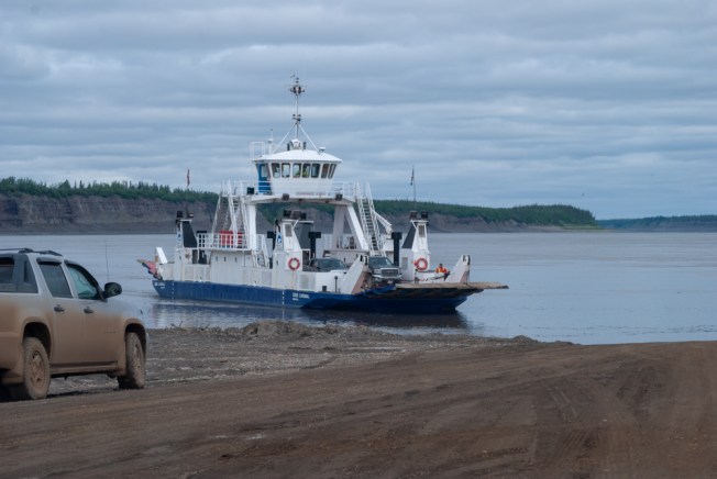
After lunch we took the ferry across the Yukon River to head up the Top World highway. The highway runs from Dawson to the Yukon/Alaska border. What amazing views! You really do feel like you are on the top of the word. I had really wanted Linda to see it and was happy that she found it as stunning as I did. We had lots of time to take some pics, and even found a bit of the old road while bushwhacking. Eventually were chased back into the car because of a thunder storm. On our way back to town we only had a 2 ferry wait to get across the river. When we got to the campground we heard that it had been a 3 hour wait to get across earlier in the afternoon.

This was the fist day we had been truly thankful we were not on the bikes, as we were able to bring our pop-up shelter with us in the car and could to stay dry while the rains came down. Some riders from neighboring sites took refuge under it as well, so we got some stories from the road. One of the rider’s had to have his bike pulled out of the road with a front end loader as the front wheel was stuck in so deep. We also heard that the day before a rider was medevaced off the Tuk highway. The conditions of the road seem to change hourly.

While we were having beverages out of the rain, we heard a helicopter go up, followed shortly thereafter by water bombers. The lightening must have started a fire not to far out of town. The planes stopped after a short while, so hopefully it was a small fire, quickly contained.

After a supper at the campsite, we headed out to catch the can-can show at Gerties. It is quite a good show, with much more than just can-can dancers. And is a must-see if in Dawson City.  While waiting for the show, we made another donation to the Klondike Visitor’s Association by way of roulette and 21. The table minimums are pretty low and the players are quite relaxed. Linda even gave up slots and played 21 instead.img_1478

We called it a night pretty early, still tired from the previous evening. It was still raining when we went to bed, and thankfully the tent was nice and dry inside. We are quite impressed with the tent, even more so considering we paid very little for it.

Tuk 2018 – Days 4 & 5 – Dawson City, Solstice Sunset.

Standard
Tuk 2018 – Days 4 & 5 – Dawson City, Solstice Sunset.

Day 4 was a relaxing day in Whitehorse spent mostly visiting with old friends. It was great to be able to catch up with Beej & Norm, JF & Sylvie, and Robert & Carl.

We also needed to pick up some more fresh food for the trip and replace a couple of things that got left behind in Calgary when we did the quick pack-up of the car. We also picked up an electric cooler that was on Sale at Canadian Tire. It will have paid for itself by the end of this trip with us not having to buy ice and not having to throw out spoiled food.

Whitehorse (2 of 3)

Yukon River

We did manage to get in one touristy stop at the SS Klondike, a Parks Canada Historic Site. The SS Klondike is a paddlewheeler that operated in the 30s and 40s, taking passengers and supplies along the Yukon River between Whitehorse and Dawson City. She now sits on the bank of the river and is open to tourists. Parks Canada give guided tours and admission is free.

Day 5 had us heading back out on the road, going north on the Klondike Highway.  Linda had the pleasure of listening to me tell stories about everything along the road until we passed Lake Laberge, as this was my stomping grounds for many years.

We stopped for lunch at 5 fingers rapids. The Yukon River splits into 5 channels here, and not all of them are navigable, only one was deep enough for the paddlewheelers that traveled the river. There is still a cable that the ships used to pull themselves up the 2-foot falls. From the lookout there are stairs to go down the escarpment and a path to walk to the rapids, it takes around an hour round trip.Day 5 (1 of 2)

Next stop was a photo-op an hour outside of Dawson City, the Tintina Trench lookout. This is a large valley formed by the separating of a fault line some 8 million years ago. The 2 plates of the fault line have shifted over 450km from where they were 65 million years ago. It is a great view from here and a great place to contemplate how tiny a blip we are in the history of the planet.Day 5 (3 of 1)

Our stop for the night, and our home for the next 3, was the Goldrush Campground in downtown Dawson City. The sites are really made for trailers, not tents, and have no shade, but the facilities are well kept, we have power for our cooler, and it is in walking distance to most things in Dawson. We brought our pop-up canopy with us, so we have shade, and the double size air mattress keeps us off the rocks at night.img_1464

After we set up camp, we headed over to Diamond Tooth Gerties Casino to make a donation to the Klondike Visitors Association. After we left our money on the table and in the slots, we headed over to the Downtown Hotel so Linda could do the Sourtoe Cocktail. For $5 plus the price of a shot of something 40% you can have a human toe put in your drink, if it touches your lip, your get a certificate and membership card for the Sourtoe Cocktail Club.

While we were waiting for the toe to start, we got to listen to a great piano player. He was the Stompin Tom of piano, complete with a board under his foot. He has a diverse repertoire, and takes requests. He plays from 7-9 nightly and its definitely worth a visit to hear him play.

To end the night we sat by the river, and watched the solstice sunset at 12:50am. We didn’t manage to get up for sunrise at 3:57.img_1460

Tuk 2018 – Day 3 – Whitehorse Ho

Standard
Tuk 2018 – Day 3 – Whitehorse Ho

Day 3 we managed to sleep in a wee bit. In the middle of the night the flies went somewhere to sleep, alas they were back in the morning and brought some friends with them. It really did require some effort to make myself believe that they were on the outside of the tent (which they were) when I could see them so plainly through the screened tent peak.

Today we shared the duties of striking camp, had a cold brekkie and headed out for Whitehorse. There is a herd of bison that live in the area around the hot springs and we hoped to see some along the way. As we were traveling down the highway, there was a car stopped on the side of the road. By the time we could see what they were stopped for it was too late to hit the breaks for a photo op. There was a bison rolling in a sand/dust pit on the side of the road. It is unusual to see just one bison and as we continued down the road we were hoping that this wasn’t the only one of the herd that had come to the roadside.

bison (2 of 3)We weren’t to be disappointed. 10 minutes down the road traffic was stopped as a large herd made its way across the highway. Although bison can move pretty quickly when they have a reason to, they usually saunter along which is exactly how they were crossing the road. Since they were taking their time, we were able to take quite a lot of pics.

The Alaska Highway does a bit of dipsy-doodling between BC and Yukon. The first foray into Yukon at mile 565 barely has any signage. I suppose that is because you only stay there for a few minutes then your back in BC. The official sign comes a bit later, shortly before you get to Watson Lake. Just before Watson Lake is what used to be Contact Creek Lodge. It is no longer a lodge, but they do have fuel with better prices than Watson Lake. They also have soft serve ice cream, which was the worst ice cream that Linda had ever had.yukon sign (1 of 1)

Watson Lake was our next stop at its famous sign-post forest. The “forest” was started in 1942 by a US soldier who was working on the Alaska highway put up a sign with the name of his home town and the distance to it. Since then it has grown to over 78,000 signs and visitors are welcome to add their own signs to it. We even saw a Manx sign, which made me smile (and snap a pic)

While we were stopped at the forest, Linda spoke to a couple of guys on adventure bikes, one of whom had flown his bike over from Bahrain. They had originally planned to ride to Tuk, but stories of serious accidents involving adventure bikes on the final section of the road had them change their plans and instead they will go to Prudhoe Bay Alaska. So, perhaps the Universe was telling us something when so many obstacles seemed to block us from the original plan of doing this trip on bikes. Since the point of this trip was to get to Tuk, a bucket list item for me, having to turn back because of bad road would have been devastating. Better to do it in a car and actually get there.

We stopped for lunch at a rest area at Rancharia Falls. Really, it is awful that I have likely driven past this 20 times or more and have never stopped. The walking path to the falls is made to be accessible, and at the end there is boardwalk so that you can get a nice view of both sides of these falls. No, they are no Niagra, but they are very pretty none the less.

In Whitehorse we were able to very briefly connect with friends Moosh and Richard as they headed out of town with their family and left us with the use of their house. Tomorrow we will get a couple quick visits with friends. It’s great to be back.

Tuk 2018 – Day 2 – Amazing vistas, hot water.

Standard
Tuk 2018 – Day 2 – Amazing vistas, hot water.

Day 2 started early, but we were well rested after  a great sleep in this quiet little campground. Linda struck camp, while I made bacon and eggs. Not a bad way to start the day, nice breakfast while watching the fish jump in the lake. The early morning fishermen were out and the fish were biting. At least one family was having a feast of grilled rainbow trout for breakfast. Next time we come up this highway we will be bringing fishing gear and getting a license.

After a quick stop in Ft Nelson for necessities like gas and beer we made our way to Steamboat. A little blip on the map with a 10% grade to get down to it, and then again back up. We were wondering would have managed more than 50km/hr going back up. At the top we stopped for a quick bite and took time to enjoy the breath taking view.

Our next planned stop, at Linda’s request, was Muncho Lake. 5 years ago when we were riding down on our KLRs Linda asked why no one knows about this place, as the beauty rivals that of Lake Louise. Quite simply it is because it is at least a 1 day drive from any major airport. We feel lucky to be counted in the number of people who have been able to see and enjoy it.

day2 (4 of 5)

Along the way to Muncho Lake we saw 5 bears and a moose. The bears were a bit elusive when we tried to get pics, but the moose was pretty cooperative.day2 (6 of 1)

After Muncho Lake, we were off for Liard Hot Springs, our destination for the night. This place is well worth the drive! It is a mostly natural hot springs, just enough done to it to make it pleasant and accessible to everyone. And everyone does stop there. We arrived just after 4 and the provincial campground was full. We likely only missed the last site by 20-30 minutes as there were only 5 vehicles in the overflow camping. We considered camping in the overflow, but it was $26 to set up our tent in the gravel parking lot. Instead we went to a private campground right next door and had a nice shady and quiet spot.

A day pass for the hot springs is only $5, and you can park right next to the boardwalk that goes to the hot springs. At the end of the boardwalk there is a change room and 2 hot pools. The bottom of the natural pools have been graveled, as they were naturally soft mud, and some benches have been installed in the upper pool. We had a lovely soak. What a great way to relax and let go the stresses of the world.

After the soak, we enjoyed dinner by the campfire then off to bed where we had to think that the sound we were hearing was raindrops on the tent and not the mass of flies trapped between the tent and the tent fly.img_1425